By Friday morning, up to 20 cm of snow is forecast in Toronto and the surrounding areas
ਸ਼ੁੱਕਰਵਾਰ ਸਵੇਰ ਤੱਕ ਟੋਰਾਂਟੋ, ਆਸ-ਪਾਸ ਦੇ ਇਲਾਕਿਆਂ ਵਿੱਚ 20 ਸੈਂਟੀਮੀਟਰ ਤੱਕ ਬਰਫ਼ ਪੈਣ ਦੀ ਸੰਭਾਵਨਾ
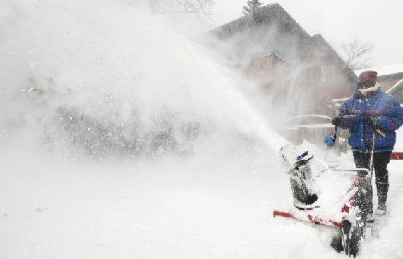
Environment Canada has issued a special weather statement for Toronto and the surrounding areas in anticipation of a snowstorm that could dump up to 20 cm of snow by the end of the week.
According to the National Weather Service, the “multi-day snowfall storm” will begin Wednesday morning and last through Friday morning.
By that time, the regions of Toronto, Halton, Peel, Durham, and York are predicted to receive anything from 10 to 20 centimetres of snow.
The announcement comes as the city of Toronto continues to clear snow after a snowfall that hit parts of southern Ontario two weeks ago.
ਐਨਵਾਇਰਮੈਂਟ ਕੈਨੇਡਾ ਨੇ ਬਰਫ਼ਬਾਰੀ ਤੋਂ ਪਹਿਲਾਂ ਟੋਰਾਂਟੋ ਅਤੇ ਆਸ-ਪਾਸ ਦੇ ਖੇਤਰਾਂ ਲਈ ਇੱਕ ਵਿਸ਼ੇਸ਼ ਮੌਸਮ ਬਿਆਨ ਜਾਰੀ ਕੀਤਾ ਹੈ ਜਿਸ ਵਿੱਚ ਹਫ਼ਤੇ ਦੇ ਅੰਤ ਤੱਕ 20 ਸੈਂਟੀਮੀਟਰ ਤੱਕ ਬਰਫ਼ਬਾਰੀ ਦੀ ਉਮੀਦ ਹੈ।
ਏਜੰਸੀ ਦੁਆਰਾ ਬਰਫ਼ਬਾਰੀ, ਬੁੱਧਵਾਰ ਸਵੇਰੇ ਸ਼ੁਰੂ ਹੋਣ ਅਤੇ ਸ਼ੁੱਕਰਵਾਰ ਸਵੇਰ ਤੱਕ ਚੱਲਣ ਦੀ ਸੰਭਾਵਨਾ ਹੈ।
ਟੋਰਾਂਟੋ, ਹਾਲਟਨ, ਪੀਲ, ਡਰਹਮ, ਅਤੇ ਯਾਰਕ ਖੇਤਰਾਂ ਵਿੱਚ ਉਸ ਸਮੇਂ ਤੱਕ 10 ਅਤੇ 20 ਸੈਂਟੀਮੀਟਰ ਦੇ ਵਿਚਕਾਰ ਬਰਫ਼ ਦੇਖਣ ਦੀ ਸੰਭਾਵਨਾ ਹੈ।
ਇਹ ਖ਼ਬਰ ਉਦੋਂ ਆਈ ਹੈ ਜਦੋਂ ਟੋਰਾਂਟੋ ਸਿਟੀ ਦੋ ਹਫ਼ਤੇ ਪਹਿਲਾਂ ਦੱਖਣੀ ਓਨਟਾਰੀਓ ਦੇ ਬਹੁਤ ਸਾਰੇ ਹਿੱਸੇ ਨੂੰ ਢਾਹ ਦੇਣ ਵਾਲੇ ਬਰਫੀਲੇ ਤੂਫ਼ਾਨ ਕਾਰਨ ਪਿੱਛੇ ਰਹਿ ਗਈ ਬਰਫ਼ ਨੂੰ ਹਟਾਉਣਾ ਜਾਰੀ ਰੱਖ ਰਿਹਾ ਹੈ।